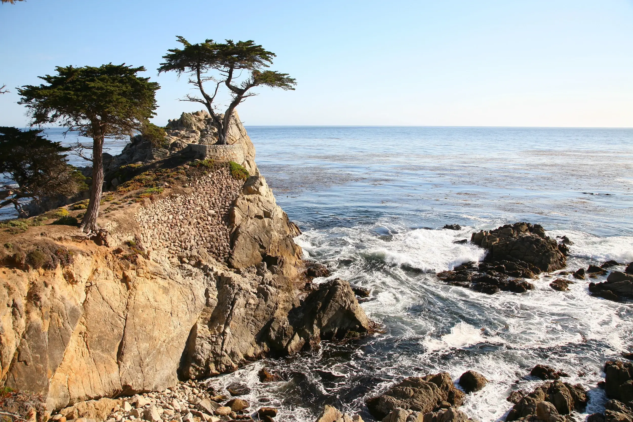
17-Mile Drive
15 min drive
This scenic loop links Carmel and Monterey, providing direct views of the Pacific coastline and iconic landmarks like the Lone Cypress. It serves as a natural transition between the two towns.

Carmel-by-the-Sea and Monterey sit four miles apart on California's central coast, close enough that visitors often treat them as a single destination. The short distance between the two towns conceals a choice: coastal scenery or direct transit. This guide maps both routes and explains what each delivers.
Quick answer
The distance from Carmel-by-the-Sea to Monterey is approximately 4.2 miles via Highway 1 north, with a drive time of 8 to 12 minutes under normal conditions. The coastal route through Pebble Beach and the 17-Mile Drive extends the journey to roughly 20 miles and 35 to 45 minutes, trading speed for oceanfront views. Both towns are accessible at all hours along public roads with no entrance fee for the direct highway corridor.
The Monterey Peninsula operates as a continuous stretch of development, and the distance carmel to monterey california reflects that proximity. Highway 1 runs straight along the inland edge of the peninsula, connecting Ocean Avenue in Carmel to the Monterey waterfront in under ten minutes. The route passes through residential neighborhoods and commercial strips before reaching Cannery Row and the municipal wharf. Drivers seeking the coastal alternative enter Pebble Beach at the Carmel Gate and follow 17-Mile Drive along a private toll road that winds past Cypress Point, Fanshell Beach, and The Lodge at Pebble Beach. The route rejoins Highway 1 near Pacific Grove, extending the trip to forty minutes and requiring a toll of ten dollars per vehicle. The scenic byway offers pullouts at Seal Rock, Bird Rock, and the Lone Cypress, but the road itself is narrow and slow, designed for sightseeing rather than transit. Carmel Valley Road provides a third option, cutting inland through hillside vineyards and connecting to Highway 68 before reaching Monterey from the east. The route measures nine miles and takes eighteen minutes, used primarily by residents avoiding coastal congestion during summer weekends and special events at Pebble Beach. The separation between the two towns has always been minimal. Carmel incorporated in 1916 to preserve residential character and forestall annexation by Monterey, which had already absorbed Pacific Grove's waterfront. The boundary remains visible today: Carmel ends at the Carmel River bridge, and Monterey's jurisdiction begins a quarter-mile north at Rio Road. The distance carmel to monterey california is a matter of municipal borders rather than geography, and visitors move freely between the two without noticing the transition. Parking availability shifts dramatically between the towns. Carmel's village core operates on metered street parking and small municipal lots, with two-hour limits enforced daily. Monterey offers larger waterfront lots near the aquarium and wharf, with paid parking extending into evening hours. The walk between downtown districts is impractical at seven miles, so the short drive remains the standard approach for visitors covering both destinations in a single day.
“Carmel incorporated in 1916 to preserve residential character and forestall annexation by Monterey, which had already absorbed Pacific Grove's waterfront.”
Carmel-by-the-Sea and Monterey are located approximately 4 miles apart on the Central Coast of California. Traveling between the two is straightforward via Highway 1 or local public transportation.
Highway 1 South or North
Monterey-Salinas Transit (MST) Line 4 or 5
For those driving, Highway 1 serves as the primary artery connecting both destinations. Public bus routes operated by Monterey-Salinas Transit provide consistent connections between the downtown areas of Carmel and Monterey.
The best arrival window is 00:00–23:59, though traffic patterns significantly influence travel times between Carmel and Monterey. Early morning hours offer the most consistent transit conditions before regional commute volumes increase.
—
Commuter volume is lowest before 07:00, allowing for a predictable drive. Routes remain clear until the morning rush begins.
60°F to 70°F
Visitor numbers peak, increasing congestion on Highway 1. Mid-day transit times fluctuate significantly due to heavy tourist traffic.
55°F to 68°F
These shoulder seasons offer a balance of manageable traffic and stable coastal weather. Weekday travel remains faster than weekend periods.
45°F to 60°F
Traffic density is at its lowest point during these cooler months. Rain may occasionally impact driving speeds on local roads.
Verdict: The best time to travel is Tuesday to Thursday during the morning hours of April or October to avoid peak tourist congestion.
The route between Carmel-by-the-Sea and Monterey offers several landmarks that allow travelers to explore the coastline effectively. These sites integrate well into a day trip itinerary by connecting the two destinations through scenic paths.
15 min drive
This scenic loop links Carmel and Monterey, providing direct views of the Pacific coastline and iconic landmarks like the Lone Cypress. It serves as a natural transition between the two towns.
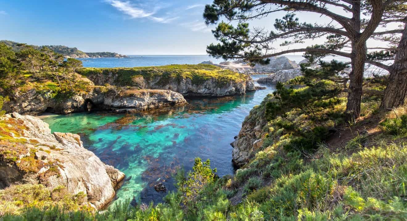
10 min drive
Located just south of Carmel, this reserve offers hiking trails and observation points for marine life. It complements a trip by providing a quiet nature-focused counterpoint to the urban centers.
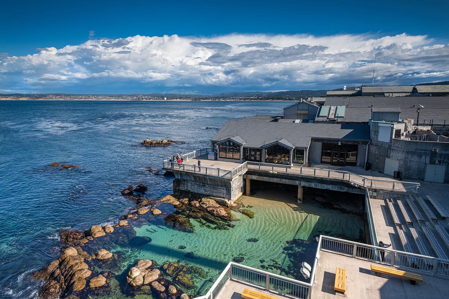
20 min drive
Situated on Cannery Row, this facility focuses on regional marine ecosystems. Its location at the northern end of the route makes it a logical stopping point for visitors traveling from Carmel.
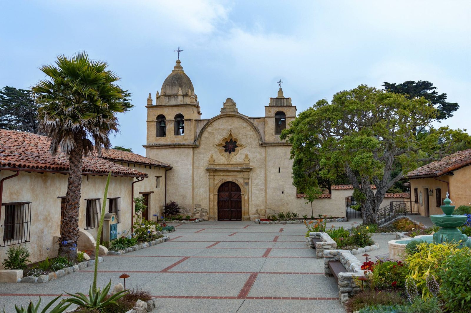
5 min drive
As one of the most authentically restored Roman Catholic mission churches in California, this site provides historical context to the area. It sits conveniently on the edge of town, marking a clear starting or ending point for the journey.
The route between Carmel-by-the-Sea and Monterey consists of public roads that remain accessible at all hours of the day. You may travel between these two locations at any time.
Everything you need to know about distance carmel to monterey california
The distance carmel to monterey california is approximately 4 to 5 miles, depending on your specific starting and ending points. This proximity makes it very easy to visit both coastal towns in a single day trip.
Most travelers find the drive takes about 13 to 15 minutes via the most direct routes. Travel times remain short throughout the day, though peak summer traffic can cause minor delays.
Yes, you can take the famous 17-Mile Drive for a more scenic experience. This route winds through Pebble Beach and offers significant coastal views, though it takes longer than the direct Highway 1 route.
You can utilize Monterey-Salinas Transit services to navigate the distance carmel to monterey california affordably. Buses operate regularly and provide a reliable alternative to driving your own vehicle.
While the distance carmel to monterey california is quite short, traffic can occasionally increase near major highway exits during busy holidays. Even with heavy traffic, the journey remains one of the shortest transitions in the region.
For those seeking efficiency, driving via Highway 1 is the standard choice. If you prefer to prioritize coastal scenery, the 17-Mile Drive is a popular alternative that highlights the beauty of the Monterey Peninsula.